Warm weather in Carbon County, Wyoming means camping.
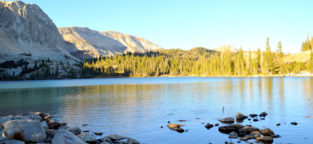
Families get together to pop up a tent, catch some fish and grill up some steaks. The Medicine Bow National Forest offers camping opportunities in the Sierra Madre Mountains, the Snowy Range Mountains and also Ryan Park. Seminoe State Park in Northern Carbon County, Shirley Basin to the Northeast and the vast high desert BLM lands nears Baggs are also great camping locations. Low impact wilderness camping is found in one of our five designated wilderness areas in Carbon County.
Bureau of Land Management Camping Information Visit Website
Medicine Bow - Routt National Forests-Thunder Basin National Grassland Visit Website
National Forest & BLM Camping Reservations Visit Website
Seminoe State Park Visit Website
Campgrounds
Battle Creek Campground
Directions: Campground is approximately 26 miles west of Encampment, WY on Hwy 70. Take NFSR 807 south 2 miles to campground turnoff. Follow the signs.
Description: 4 campsites, 2 tables, fire rings, running water, vault toilet, no host on site. Pack out trash. Very primitive campground. Fishing in Battle Creek. Hiking access to Huston Park Wilderness and Continental Divide National Scenic Trail. This is a small rustic campground on the west side of the Continental Divide. It sits beside the West Fork of Battle Creek under cottonwood trees outside Huston Park Wilderness area. All sites are first-come-first-serve.
Administered by: National Forest Service
Elevation: 7,800 feet Recommended Season: June - October Fee: No fee Stay: 14 day limit
Bennett Peak Campground
Directions: From I-80, take Wyo 130 and Wyo 230 south approximately 38 miles to Riverside, then Wyo 230 east 4 miles. Turn left onto County Road 660 and go 12 miles on graveled road to Bennett Peak Road (BLM Road 3404) and follow it 7 miles to the campground.
Description: 11 campsites, vault toilet, hand pump well, boat ramp, day use parking, bank fishing accessible to persons with disabilities. Picnic table, fire ring/grill, sandy tent pad, parking space. No pull-throughs. Riparian area - cottonwoods, ponderosa pine, Douglas fir, willows, juniper, mountain mahogany, wild rose. Bald eagle, bighorn sheep, pronghorn, wild turkey, mule deer, mountain lion, grouse, rattlesnakes, rainbow and brown trout. All sites are first-come-first-serve.
Administered by: Bureau of Land Management
Elevation: 7,200 feet Recommended Season: June 1 - Nov 15 typically Fee: $10 per night
Bottle Creek Campground
Directions: Campground is approximately 7 miles west of Encampment, WY on Hwy 70. Take NFSR 550 south 1/4 mile to campground turnoff. Follow the signs.
Description: 12 campsites with tables, fire rings, running water, vault toilet, host on site. A group picnic site is available for rent within campground. Fishing in Bottle Creek and the North Fork of the Encampment River. Hiking in Huston Park Wilderness Area, Continental Divide Trail, Green Mountain Falls Trail. Located on a hillside overlooking the Upper Platte River valley with views of Medicine Bow Peak and the Snowy Range across the valley. Hiking and fishing opportunities are located nearby. A short trail to McClure Overlook originates in the campground. All sites are first-come-first-serve.
Administered by: National Forest Service
Elevation: 8,700 feet Recommended Season: June - October Fee: $20.00 Stay: 14 day limit
Bow River Campground
Directions: Campground is approximately 15.5 miles south of Elk Mountain, WY on County Road 101. Turn right at NFRS 101/100 intersection. Continue 0.2 mile to campground turnoff. Follow the signs.
Description: 13 campsites with tables, fire rings, running water, trash pick up, vault toilet, and host on site. Fishing in Bow River and Long Lake. Hiking in Sawmill Park area. Easily accessible from Interstate 80. All sites are first-come-first-serve.
Administered by: National Forest Service
Elevation: 8,600 feet Recommended Season: June – October Fee: $14/ night Stay: 14 day limit
Corral Creek Recreation Site
Directions: From I-80, take Wyo 130 and Wyo 230 south approximately 38 miles to Riverside, then Wyo 230 east 4 miles. Turn left onto County Road 660 and go 12 miles on graveled road to Bennett Peak Road (BLM Road 3404) and follow it 6 miles to the campground.
Description: 6 campsites, vault toilet, day use parking, foot trail to wade fishing. Picnic table, fire ring and grill at most sites, parking space. No pull-throughs. Juniper, sagebrush and grasses primarily. Near riparian area. Bald eagle, bighorn sheep, pronghorn, wild turkey, mule deer, mountain lion, grouse, rattlesnakes, rainbow and brown trout. All sites are first-come-first-serve.
Administered by: Bureau of Land Management
Elevation: 7,200 feet Recommended Season: June 1 - Nov 15 typical, but quite variable. Fee: None
Deep Creek Campground
Directions Campground can be reached by NFSR 111 south of Arlington, WY. Then south on NFSR 101 for 2 miles. Follow the signs.
Description: 12 campsites, tables, fire rings, running water, vault toilets, no host on site. Fishing in Deep Creek, Carlson Creek, Sand Lake. Hiking Rock Creek Trail, Sheep Lake Trail, Crater Lake Trail. All sites are first-come-first-serve.
Administered by: National Forest Service
Elevation: 10,200 feet Recommended Season: July - Labor Day Fee: $20.00 / night Stay: 14 day limit
Dugway Campground
Directions: From Rawlins, take I-80 east 5 miles to the west Sinclair exit, then go north on County Road 351 about 7 miles to the turnoff on the right.
Description: The Dugway Recreation Site is a good choice for fishing and floating. It has 5 campsites (1 pull- through and 4 spurs), a group site, vault toilet, picnic tables, fire rings and day-use parking. It?s a good spot for spotting pronghorn, mule deer, rattlesnakes, and coyotes. You can fish for rainbow and brown trout and walleye.
Administered by: Bureau of Land Management
Elevation: 6,397 feet Fee: Free
Encampment River Campground
Directions: From I-80, take Wyo 130 and Wyo 230 south approximately 38 miles to Encampment. Follow highway through town to Wyo 70. County Road 353 is left approximately 1/4 mile west of town. Follow it one mile south to BLM Road 3407. Campground is about 3/4 mile.
Description: 8 campsites, vault toilet, day use parking, foot trail. Encampment River for fishing, floating and hiking Encampment River Trail. Picnic table, fire ring/grill, sandy tent pad, parking space. No pull-throughs. All sites are first-come-first-serve.
Administered by: Bureau of Land Management
Elevation: 7,200 feet Recommended Season: June 1 - Nov 15 Fee: $10 per night.
French Creek Campground
Directions: Campground is approximately 25 miles east of Saratoga, WY on Hwy 130. Then south on NFSR 225 and NFSR 206 for 15 miles. Follow the signs.
Description: 11 campsites with tables, fire rings, running water, vault toilets, host on site. Fishing in North and South French Creek. Hiking the French Creek Canyon Trail and Tie Hack Trail. Close to north boundary of the Savage Run Wilderness area. All sites are first-come-first-serve.
Administered by: National Forest Service
Elevation: 8,000 feet Recommended Season: June 15 - October Fee: $14.00 per night Stay: 14 day limit
Hog Park Campground
Directions: From Encampment, Wyoming, travel west on Highway 70 approximately 6 miles. Turn left on Forest Road 550 and travel south about 16 miles to the junction of Forest Roads 550 and 496. Stay left and travel 3 miles. The campground is south of the dam.
Description: Hog Park Campground offers a peaceful setting on the southeast shore of Hog Park Reservoir. The campground provides access to the water for boating, fishing and water sports, as well as options for hiking the Continental Divide National Scenic Trail. It lies high in the Medicine Bow-Routt National Forests at an elevation of about 8,400 feet. Hog Park has 50 sunny campsites, spread over three loops in the campground. Facilities include picnic tables, drinking water, fire grates, vault toilets and trash service. There is a boat ramp near the campground. Fishing is excellent for brook and rainbow trout, and boating and water skiing are allowed on Hog Park Reservoir. Two picnic areas are nearby. There are numerous day hiking and backpacking opportunities in the Huston Park, Encampment River and Mount Zirkel Wilderness Areas, all within a short drive.
Administered by: National Forest Service
Elevation: 8,400 feet Recommended Season: June - September Fee: $20 per night.
Jack Creek Campground
Directions: Campground is approximately 19 miles west of Saratoga, WY on County Road 500. Then approximately 8 more miles on NFSR 452. Follow the signs.
Description: 16 campsites with tables, fire rings, running water, trash pick-up, vault toilets, host on site. Maximum combined vehicle/trailer length is 22 feet. Fishing in Jack Creek and McLain Creek . Hiking the Continental Divide Trail. Moose watching. All sites are first-come-first-serve.
Administered by: National Forest Service
Elevation: 8,500 feet Recommended Season: Mid-June thru October Fee: $14.00 Stay: 14 day limit
Lincoln Park Campground
Directions: Campground is approximately 20 miles east of Saratoga, WY on Hwy 130. Then north on NFSR 100 for approximately 2.6 miles.
Description: 11 campsites with tables, fire rings, running water, trash pick-up, vault toilets, host on site. Fishing in Brush Creek. ATV trail located across from campground. (Stump Hollow ATV trail). Wildlife viewable in the area include deer, moose and elk. All sites are first-come-first-serve.
Administered by: National Forest Service
Elevation: 8,000 feet Recommended Season: June 15 - October Fee: $20.00 per night Stay: 14 day limit
Lost Creek Campground
Directions: Campground is approximately 18 miles southwest of Encampment on State Highway 70.
Description: 13 campsites with tables, fire rings, running water, trash pick-up, vault toilets, host on site. Fishing in steams nearby. Hiking to Baby Lakes and Huston Park Wilderness. Wildlife viewable in the area include deer, moose and elk. All sites are first-come-first-serve.Elevation: 8,800 feet Recommended Season: June 15 - October Fee: $20.00 Stay: 14 day limit
Pike Pole/Pickaroon Campground
Directions: From Laramie, take WY 130 west 21.7 miles to WY 11. Turn left and go 13 miles to Albany. From Albany, take Forest Route 500 2.8 miles to Keystone sign at FR 542. Continue east, first on FR 511, then on FR 512 (same road) for about 12 miles. These two campgrounds are right next to each other. If you have four wheel drive you can travel southeast of Encampment about 16 miles on WY 230 and then east on FR 3423 about 4 miles. Please note that FR 3423 is not a maintained road and is intended for 4WD vehicles only.
Description: These 8 sites in Pickaroon and 6 sites in Pike Pole are wedged between the Savage Run Wilderness and the Platte River Wilderness. Trailhead in campground is for the Douglas Creek Trail (Platte River Wilderness). This is primative camping with no services available. All sites are first-come-first-serve.
Administered by: National Forest Service
Elevation: 7,800 feet Recommended Season: June 15 - October Fee: None Stay: 14 day limit
Prior Flat Campground
Directions: From Medicine Bow, take Wyo 487 north approximately 21 miles and turn left onto Wyo 77. Follow Wyo 77 about 9 miles and take County Road 102 west for about 9 miles to the Shirley Mountain Loop Road (BLM Road 3115). Campground is just up the hill about 1/4 mile.
Description: The Prior Flat Campground has 15 campsites and a vault toilet on about 9 acres. It has one pull-through, picnic tables, fire rings/grills and parking spurs. The campground is located at the foot of the Shirley Mountains, a remote range in a large basin between the Medicine Bow and the Ferris Mountains. Visitors will enjoy the aspen, limber pine, lodgepole pine, big sagebrush and can view pronghorn, mule deer, elk, coyotes, grouse and golden eagles. The Shirley Mountains offer fantastic hunting opportunities and fishing in Sage Creek.
Administered by: Bureau of Land Management
Recommended Season: June 1 - Nov 15 typically Fee: $10 per night
Ryan Park Campground
Directions: Campground is approximately 20 miles southeast of Saratoga. From Saratoga, travel south on Highway 130/230 approximately 8 miles to junction, turn left and travel east on Highway 130 approximately 12 miles to Ryan Park Campground.
Description: 48 campsites with tables, fire rings, running water, trash pick-up, vault toilets, host on site. Campground consists of three loops, and reservations may be made by calling (877) 444-6777 or at www.reserveusa.com . The lower loop may only be reserved as a group loop Campground is the site of a Civilian Conservation Corp and Prisoner of War Camp. Has interpretive signs telling about the CCC and POW camps. Fishing in North French Creek and other small streams. Hiking and Horseback riding on old closed roads, open two track roads, and gravel roads in the area.
Administered by: National Forest Service
Elevation: 8,000 feet Recommended Season: June 15 - October Fee: $20/Single Site & $125/Group site (140 Max) Stay: 14 day limit
Seminoe State Park Campgrounds
Directions: 37 Miles north of Sinclair on Seminoe Road.
Description: Seminoe State Park offers excellent fishing, boating, hiking and wildlife viewing opportunities. Seminoe Reservoir is 21 miles long with 2 major tributaries, the North Platte River and the Medicine Bow River. Boating access to the Reservoir can be made in the park at the North and South Red Hills boat ramps. Campsites can be used by RVs or Tent campers. There are 3 campground areas North Red Hills, South Red Hills and Sunshine Beach. Seminoe Reservoir offers some great fishing for both trout and walleye. Good river fishing can be found a short drive from the park along the North Platte River from I-80 at Fort Fred Steele State Historic Site all the way to the Gray Reef Area below Alcova Dam. In between lies the famous “Miracle Mile,” well-known for its blue ribbon fly fishing.
Administered by: Wyoming State Parks
Elevation: 6,390 feet Season: Year Round Fee: Residents $18.30 / Non-Residents $32.34
Silver Lake Campground
Directions: From Saratoga travel south on Highway 130 for 8 miles to the 130/230 intersection. Turn left and travel 24 miles up Highway 130 to Silver Lake Campground. From Centennial stay on Highway130 for 18 miles to reach Silver Lake Campground.
Description: At just under 10,500 feet Silver Lake Campground is the highest elevation campground on the Brush Creek/Hayden Ranger District. It opens in late June or early July depending on snow depth. The campground is beside the Snowy Range Scenic Byway on Silver Lake. This facility provides easy access to exploring the trails, lakes, streams, and glacial landscapes of the area. Facilities include 17 campsites with 3 RV pull-throughs (trailers under 32'), picnic tables, toilets, water, fire grates, and trash receptacles with a 14 day stay limit. There are two trailheads at the campground. Popular attractions near this campground include Silver Lake, Lake Marie Falls, Mirror Lake, Medicine Bow Peak Trail, French Creek CanyonTrail and Miners Cabin Trail.
Administered by: National Forest Service
Elevation: 10,500 feet Recommended Season: July through September Fee: $20/ night Stay: 14 day limit
Six Mile Gap Campground
Directions: Campground is approximately 26 miles southeast of Encampment. Travel south on Highway 230 26 miles to National Forest System Road 492, turn left and travel two miles to Six Mile Gap Campground.
Description: 9 campsites with tables, fire rings, hand pump, trash pick-up, vault toilets, host on site. Campground is a combination of walk-in tent sites and camper sites. Popular access to the Platte River Wilderness and to the Platte River for floating. Fishing in the Platte River. Hunting in the general vicinity. Wildlife seen in the area includes elk, deer and big horn sheep. All sites are first-come-first-serve.
Administered by: National Forest Service
Elevation: 8,000 feet Recommended Season: May 15 - October Fee: $20/ night Stay: 14 day limit
South Brush Creek Campground
Directions: Campground is approximately 22 miles southeast of Saratoga. From Saratoga travel south on Highway 130/230 approximately 8 miles to junction 130/230, turn left and travel ten miles to junction of Highway 130 with National Forest System Road (NFSR) 100, turn left and travel ¼ mile to junction of NFSR 100 and 200, turn right and travel 1.5 miles to campground.
Description: 20 campsites with tables, fire rings, hand pump, trash pick-up, vault toilets, host on site. Trail to the Brush Creek Visitor Center located above campground. Fishing in Brush Creek and various other small streams. All sites are first-come-first-serve.
Administered by: National Forest Service
Elevation: 7,900 feet Recommended Season: June 1 - October Fee: $20.00 per night Stay: 14 day limit